Ausable River Cut Conservation Area (ARCA)
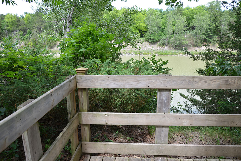
The Ausable River Cut Conservation Area is the former Thedford Conservation Area. It is one of the last remaining public rest stops for travellers of the Bluewater Highway. Visitors can enjoy a stroll on the nature trail through this forested area within the important Carolinian Zone. The developed recreational trails offer views of the scenic Ausable River.
Open seven days a week, from sunrise to sunset, unless otherwise posted.
Watch for an updated trail map and booklet, coming soon.
Where is Ausable River Cut Conservation Area?
Address: 9984 Northville Crescent, Thedford, Ontario
You may find this Google Map helpful:
- Ausable River Cut Conservation Area - Google Map
Recreational Trails
Explore the Ausable River Cut’s one-kilometre (0.6-mile) recreational trail and travel through the Oak Savanna and dunes.
Our multi-use recreational trails are accessible by foot, snowshoes or cross-country skis – weather permitting.
CAUTION: These are nature trails. Trail surfaces may be slippery or uneven. Be especially careful during windy, wet and icy conditions.
- Use caution and avoid trails if covered in water.
- Wear appropriate clothing, footwear and equipment for your preferred trail activity.
- Stay away from fast-flowing water.
Fishing
Fishing is permitted in compliance with applicable legislation.
Outdoor Cards and Fishing Licences can be purchased from Service Ontario and other licence issuers.
Please release any fish caught out of season.
There is a number of native species in the Ausable River.
Rules and Regulations
Rules
Rules protect the environment, you and your fellow users. These rules must be followed and are be enforced under the Conservation Authorities Act and Trespass to Property Act.
Please refer to signs and entrance kiosks for permitted and prohibited activities.
- The property is closed to the public between sunset and sunrise.
- Motorized vehicles, bicycles, e-bikes, horses, hunting, alcohol use, drones, fires and camping are not permitted.
- Dogs must be on a leash, under control, and you must clean up after your dog. Ensure your pet does not damage or interfere with vegetation or wildlife and does not interfere with others’ enjoyment.
- Do not remove or damage plants, trees, wildlife, signs or structures.
- Stay on the trails and respect neighbouring landowners.
- Fishing is permitted in compliance with applicable legislation.
- Don’t litter.
Please report vandalism and incidents to the Ausable Bayfield Conservation Authority (ABCA) at 519-235-2610 or toll-free 1-888-286-2610.
Permitted Activities
Hunting and motorized vehicles are not permitted.
For permitted (and prohibited) uses, please visit the 'Permitted Uses' web page at this link:
Watch the video now:
Master Plan for Ausable River Cut Conservation Area
Thank you to everyone who provided input into the Draft Master Plan for Ausable River Cut Conservation Area. The 35-day consultation period ended on Tuesday, March 31, 2026.
The participation in the survey to provide comments and input into the draft Master Plan for Ausable River Cut Conservation Area helped to shape the best possible plan for the future.
Here, approved by the ABCA Board of Directors on April 16, 2026, is the Master Plan for Ausable River Cut Conservation Area – 4 MB (large) PDF file