Weather Network meteorologist speaks
Weather Network meteorologist Mark Robinson speaks on extreme weather in Great Lakes region at ABCA’s annual Flood Emergency Planning Meeting
Community Emergency Management Coordinators among more than 40 participants at annual Flood Emergency Planning Meeting in Exeter
Meteorologist and storm chaser Mark Robinson, of The Weather Network, spoke on March 28, 2023 about Extreme Weather in the Great Lakes Region. He was the keynote speaker at the annual Flood Emergency Planning Meeting hosted by Ausable Bayfield Conservation Authority (ABCA).
Robinson, who has been present at 25 different hurricanes, is co-host of the television series StormHunters and Unearthed. The speaker shared his experiences chasing storms including personal encounters with tornadoes.
It can be a challenge to forecast storm events in southern Ontario as storms pick up moisture as they pass over the Great Lakes, according to the presenter. Storms often develop along the lines of lake breezes blowing off of Lake Huron and this has the potential to cause severe weather and heavy rains.
Ontario is not immune to tornadoes, Robinson said. There were 60 confirmed tornadoes in Ontario in 2021 and, Mark said, more than 40 of those were in southern Ontario. “When we have these tornadoes in southern Ontario we’re talking about an extremely densely populated area and that is a big problem,” he said. “Yes, we see tornadoes, we see storms, just as strong in southern Ontario as we do down south,” he said. “We’ve had multiple EF-4s.”
The Goderich tornado was an example of a tornado that started on Lake Huron, Robinson said. (One person died and 37 were injured in that August 21, 2011 tornado, which was a severe F3 tornado on the Fujita Damage Intensity Scale).
“No country in the world gets more tornadoes than the United States,” Mark told the crowd of more than 40 people. “We (in Canada) come a very close second,” he said. “The geography of North America is set up perfectly to be a thunderstorm producing machine.”
As a storm chaser, Mark has had a front-row seat for some major storms. He shared an example of a supercell storm, that produced a tornado, about 1.5 kilometres wide, near Point Clark, where he was present. That storm started out on the lake. “The funnel itself was buried way back into the storm itself,” he said. “This is the big issue with southern Ontario storms … because we have that extra shot of moisture from the Great Lakes, it gives us high-precipitation supercells.” With a tornado in Kansas, for example, the funnel might be clearly defined and seen whereas in an Ontario storm that tornado might be buried inside a wall of precipitation.
The Tornado Alley area doesn’t stop at the U.S.-Canada border but extends northward. One difference between Ontario and some midwestern or southern states of the United States is the extent of the impacts tornadoes tend to have. Most people have basements in Ontario so, in general, the impact may not be as severe as warm-weather locales, such as the southern U.S. states, where often buildings do not have basements.
A supercell thunderstorm may not be the most common type of storm in Ontario but it is a particular concern. Sometimes called ‘rotating’ thunderstorms, supercell storms have a rotating updraft or ‘mesocyclone.’ “Supercell storms don’t mean big storms,” Mark said. “Sometimes people think supercell means giant storm ... what it means is the central core of the storm is spinning.” The supercell storms in Ontario sometimes aren’t as big as the storms in other parts of North America, such as the Tornado Alley region, but these storms in Ontario can still have tornadoes associated with them.
The presenter showed a video of an EF-5 storm, outside of Winnipeg, with a mini-van, and even a house, uplifted and spun around in the tornado.
When people see a green sky during a storm event that’s generally because of the presence of hail, according to the speaker. “What happens is you get the sunlight being filtered through and only the greens and blues make it through to your eye,” he said.
It is often easier to predict the approach of winter snowstorms than it is to predict a supercell thunderstorm, according to the presenter. The thunderstorms can be among the most destructive and also the hardest to predict.
The La Niña climate pattern, which leads to heavy rain and flooding in parts of Canada, has taken place for three years in a row. “We’ve never had three years running of a La Niña situation,” Robinson said. “This is the first time we’ve ever had that.” This exceptional weather situation makes it harder to know what to expect in terms of coming weather events.
There isn’t enough evidence to connect any single event, such as a hurricane or fire, to climate change, he said, but if we look at 30 years of data we can begin to see changes happening to climate even in southern Ontario. The effects right now may not be as significant as in the west coast, or Texas, or Antarctica, but there are changes, to Ontario’s weather, resulting from global warming. One of those changes is to extreme precipitation events and an increase in clusters of storms. There is also a shifting of Tornado Alley towards the northeast which brings it farther into southern Ontario.
It’s not always possible to link major storm events, in any given year, directly to the effects of climate change but looking over a 30-year period, the impacts of a changing climate are being seen, according to the presenter. “We are already beginning to see some of the effects of climate change in southern Ontario and across North America,” according to Mark. The number of extreme rain and snow events is likely to increase, he said. “We are seeing the probability of those nastier events increasing over time,” he said. “How fast that’s going to occur, that’s something we’re still working on.”
Southwestern Ontario may be less affected by climate change in the short term than some other parts of North America, he said. This part of North America could be a climate “refuge” of sorts, in the near term, compared to some other parts of North America, such as Texas and other southern states.
The flood emergency planning meeting took place on Tuesday, March 28, 2023 in the Masonic Hall in Exeter. ABCA was able to host the event in person this year. There were 47 people who attended the meeting, including municipal Community Emergency Management Coordinators; local public health staff; police; Emergency Management Ontario; and county municipal representatives.
Staff from ABCA provided a review of the roles and responsibilities of the Province of Ontario; municipalities; conservation authorities; and other agencies during flood events. They spoke, at the annual Flood Emergency Planning Meeting, on the flood forecasting and warning program and provided a spring flood outlook.
Ross Wilson, ABCA Water and Soils Resource Coordinator, spoke on operation of Parkhill Dam; shoreline monitoring and messaging; and river watch, ice jams, and event monitoring and communications. ABCA staff collect data in the field with ‘boots on the ground’ and ‘eyes on the ground’ through river watch monitoring and by measuring, in the field, snowpack density.
Davin Heinbuck, ABCA Water Resources Coordinator, described the Meteorological and Environmental Data Network ABCA uses. This network collects data from the Parkhill Climate Change Station; from the Volunteer Rain Gauge Network; and from the Provincial Groundwater Monitoring Network. At stream gauge locations, ABCA collects data on precipitation; air temperature; water temperature; wind speed; wind direction; solar radiation; and soil moisture. Davin provided a spring flood outlook indicating there was no risk of ice jams with no significant snow pack and river ice gone but that there was saturated ground so runoff would move quickly in the case of large rain events.
Davin outlined the key players in flooding emergencies. He outlined the roles and responsibilities of the conservation authority, municipalities, and the Province of Ontario. He also described ABCA’s Flood Emergency Plan. He provided numerous examples of local flooding. He explained how ABCA protects life and property through programs that manage natural hazards such as flooding and erosion. Davin also explained the different levels of flood messages.
Those messages include Watershed Conditions Statements (Flood Outlook and Water Safety); and Shoreline Conditions Statements (for flooding and erosion). He also described the more serious levels of flood messages which are Flood Watches; and Flood Warnings (the most serious level of message for flooding that is imminent or occurring). He described how a ‘watch’ has the ingredients that would make a flood event possible and the warning indicates the ingredients are mixed together and have become a storm.
To learn more visit the flood messages page.
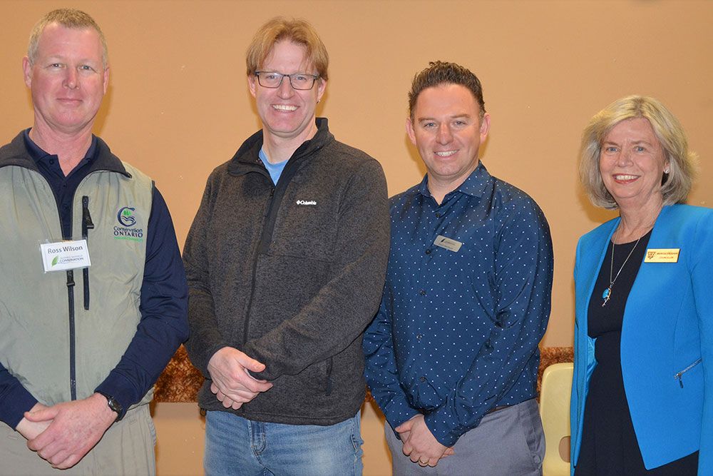
PHOTO OF FLOOD EMERGENCY PLANNING MEETING 2023: Shown in the photo are the four presenters at the Annual Flood Emergency Planning Meeting, hosted by Ausable Bayfield Conservation Authority (ABCA), and held at the Masonic Hall in Exeter on March 28, 2023. From left to right in photo are, Ross Wilson, ABCA Water and Soils Resource Coordinator; keynote speaker Mark Robinson, meteorologist and storm chaser, of The Weather Network; Davin Heinbuck, ABCA Water Resources Coordinator; and Marissa Vaughan, Chair of the ABCA Board of Directors.