Be aware of bluffs, slopes
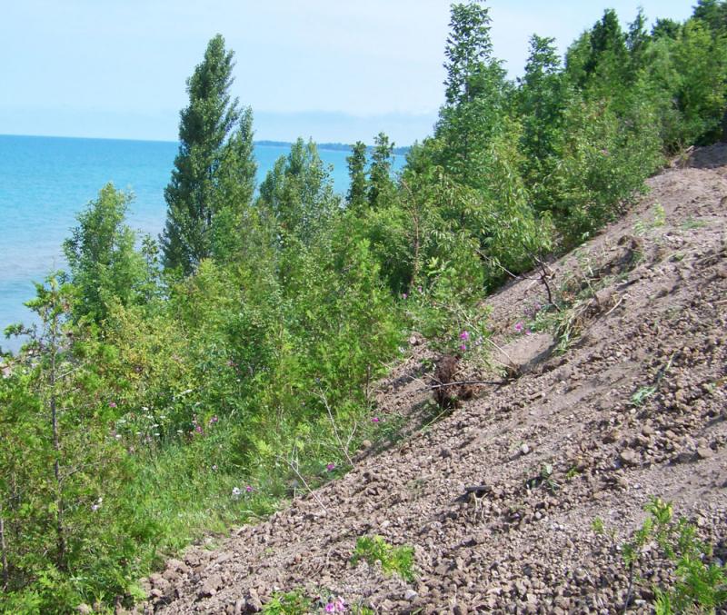
Higher lake levels, shoreline erosion, weather events make it important for property owners to be aware of hazards, risks
Lake Huron water levels at highest in years; higher water combined with wet ground, natural hazards, pose risks of more gully and bluff erosion; potential slope failure
Lake levels are the highest they have been in years. These higher-than-average lake levels, combined with large amounts of rain, high winds and wave action due to sparse ice cover has led to erosion at the base of the bluffs and an increase in gully erosion in some areas. This in turn leads to higher risk of slope failures along the lakeshore.
Water levels in Lake Huron are above the long-term average and higher than this time last year. Lake water levels are, in fact, higher than they have been since 1998 and they have rebounded from the period of lower-than-average levels that took place between late 1999 and early 2014. “Property owners should be aware of shoreline risks and natural hazards and remain diligent in monitoring their property for any sign of potential slope failure or bluff collapse,†said Alec Scott, Water and Planning Manager with Ausable Bayfield Conservation Authority (ABCA). “Unfortunately, it is very difficult to predict when bluff failures will happen and how big those failures will be.†It is important for property owners to regularly check the condition of their bluff and property and if they have any concerns, to seek advice from appropriately qualified engineering and technical professionals. In the event of a significant bluff or slope failure that impacts residential structures, property owners should notify their municipality and the ABCA immediately.
Factors affecting bluff erosion include wave action, lake levels, groundwater flow and saturation, wind, freeze-thaw cycles, bluff height, soil type, and the angle of the bluff. Heavy rainfall in early 2016, combined with a number of freeze-thaw cycles this past winter, increases the potential for erosion along the Lake Huron shoreline. Saturated clay-till bluffs, combined with erosion from wind, storm events, and higher lake levels, can lead to increased slope instability along the shoreline and increased erosion of gullies.
Environment and Climate Change Canada records indicate that March precipitation across the entire Lake Huron basin (Lake Huron, Lake Michigan and Georgian Bay) was almost double the long-term average for the month of March. In Ausable Bayfield watersheds, the precipitation was even higher. Based on three indicator stations, which are part of the ABCA precipitation monitoring network, average rainfall for March was close to three times the normal amount.
In an average year, lake levels in Lake Huron would typically rise approximately four (4) centimetres (cm) in February and March, according to Frank Seglenieks, Water Resources Engineer with Environment and Climate Change Canada. In February and March of 2016, lake levels rose about 14 cm. This increase represents the fourth largest rise at that time of the year since the start of water level tracking in 1918, according to Seglenieks. Lake Huron water levels in March of this year were 13 centimetres above the same period the year before and 32 cm above the long-term average for March. (This year’s March level is still 51 cm below the record March level set in 1986).
The lake level in Lake Superior, which contributes a significant proportion of water supplies to Lake Huron is also well above average and will continue to contribute to the high levels experienced in Lake Huron for at least the rest of this year. As a consequence, it is predicted that water levels in Lake Huron will remain above average this year even if weather conditions are fairly dry.
There are inherent natural hazards and risks along any shoreline. Higher water levels and wet weather add to that risk, according to the ABCA. Bluff erosion is a natural process that has been occurring along the Great Lakes shorelines since they were formed more than 10,000 years ago. This erosion process is necessary to the ecology of the shorelines as sand beaches would disappear without some erosion. However, with higher lake levels and more rain events early this year, the erosion process is now much more visible. Property owners need to be aware of the increased erosion and slope failure potential and watch for any sign of slope failure on their property. ABCA encourages property owners to contact the conservation authority with any questions.
The ABCA is currently updating its Shoreline Management Plan and is working with a Steering Committee and consulting team to complete this work. Information about the Shoreline Management Plan may be obtained from the ABCA’s website at: http://www.abca.on.ca/page.php?page=shoreline-management
The conservation authority is adding new information materials on this web page in the coming weeks.